Today was a big ride, frankly the one I wanted to come to this area to do. After the experience on Figueroa Mountain Road and Santa Rosa Creek Road I think we were keptical on how difficult this climb and ride would really be. In the end, it was tough but not nearly as tough as we pictured it.
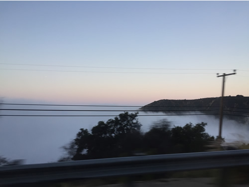
The day started off by Tom and I dropping Molly off at the Hyatt so she could catch the bus back to LAX for the trip home. Tiffany chose to not ride and to work a bit and to go for a run instead. The drive over San Marco pass was pretty cool as the clouds cleared going over the pass but on the Santa Barbara side, we found ourselves above the cloud bank and descending back though it.
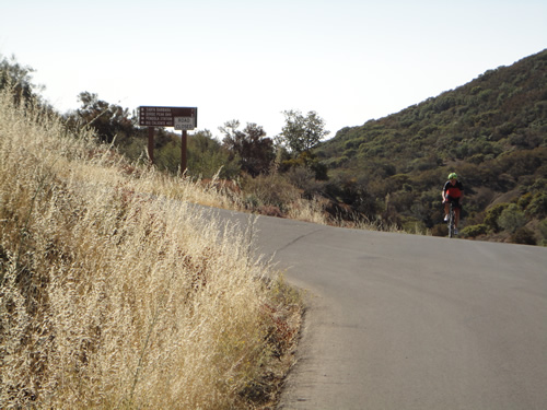
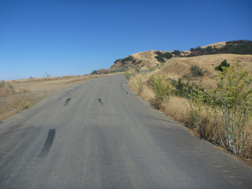
We intended to start from a local park, but found it didn't open until 30 minutes after we wanted to start. Luckily we found a local school that was pretty convienient and parked there for teh ride. It was cool and overcast but frankly that was a positive and probably helped us not run out of water like on Figueroa Mountain. The initial 9 miles or so was along the foot hills of the Santa Ynez Mountains and was a nice rolling warmup for the real climb to come. Soon we were heading up Mountain Road which fed directly into Gibraltar Road. The climb started out fairly steep and while Tom recorded his customary video, the anticipation and oxygen debt from the steep start caused an operator error and as a result, for the first time since the videos started, there was no "Adios from Gibraltar Road". I can attest that we did make one and it was an awesome one . and there was an Adios ... it's just like the tree falling in the woods .. if it's not recorded ... did it really happen? You can hear some of the best parts in tomorrow's video on Refugeo Road .. although it's not the same!
The climb up Gibraltar Road was difficult, but really not hard until about 1.1 miles from the top where is got severley steep for the rest of the climb. I think it's fortunate we did this ride late in the week as even though I was tired, the steep slopes didn't see nearly as bad as Figueroa Mountain. There was a lot of really nice development on the climb with what I assume is some very expensive real estate considering the views. About half way up, there was a big switch back and the climb almost leveled. It was about here that I noticed a group of peple running up the climb. I had passed a guy onthe lower clopes running but was impressed to find people running up higher. As it turns out, two of teh group were dropped pretty easy, but this one guy was pretty fast. He was so fast in fact that for the next several miles that he kept pace with me riding. It was bizzare riding as hard as I could up hill and hearing clomp clomp clomp clomp of a runner about 25 yards behind me It was so annoying in fact that I was complely motivated by those running steps to not let him catch me. Luckily I finally dropped him on the very steep section but when I was at the top with Tom, the runner finished and after basically asking how the hell he race that fast up those slopes, we found out he was training for a race called Pier to Peak, where they start at the ocean in Santa Barbara and finish on the top of La Cumbre Peak. It is an uphill Half Marathon and is billed as " The Worlds Toughest Half Marathon" and you know what? I have to belive that is easily true. Below is the Pier to Peak promo vid ... I included it as you can see how insane that race is! It also has some nice video of the roads we climbed.
Here Tom caught a good shot of me cresting the top of Gibraltar.
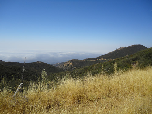
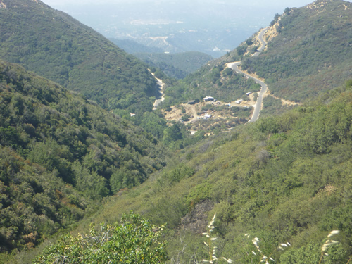
The top of Gibralter Road wasn't the highest point of our ride. We also climbed almost to the top of La Cumbre Peak also, but first we turned right and did a smaller climb and headed out to the eastern end of the paved section of East Camino Cielo. Along that road we had a nice chat with a local rider but also saw some fantastic views looking back down on the Gibraltar Road which we had just climbed. If you look closely you can see way down the valley where we started! Below are some of those views:


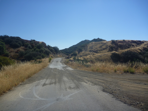
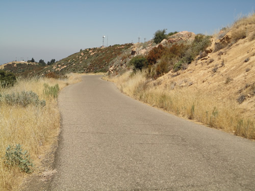
The road itself was very remote but had some car travel. In particular, we saw four wheelers and also horse trailers.
After about 5 miles we did reach the end of the road. The guy we were riding with had taken off on one of the descents and either rode though the dirt section or off a cliff, I'm not really sure!
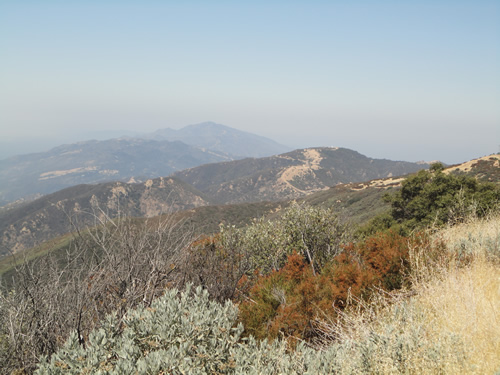
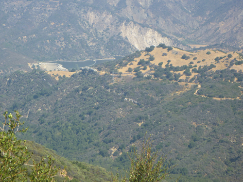
When we turned aourn to head back towards Gibraltar, the views acorss the western slope were amazing also. We had great views of the Gibraltar Dam and Gibraltar Resevoir which is the primary water suplpy for the city of Santa Barbara. For the first time in 6 years in January 2017, the resevoir filled up and spilled over the dam generating electricity and filling the Santa Ynez River.
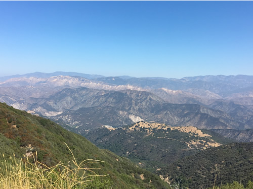
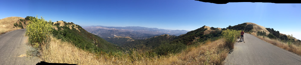
I took this panorama shot which is kind of interesting.
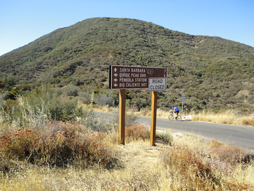
Once we returned to the junction, we headed off across teh ridge towards where we were going to descent. The road was marked as closed, but we aren't sure why? Anyway, there was a pretty descent climb to La Cumbre before things leveled off again. Tom, we actually missed a chance for a small addional climb to teh peak, but I think we probably climbed enough on this ride!
A second short climb lead to some sort of a facility with some radomes and other antennas.
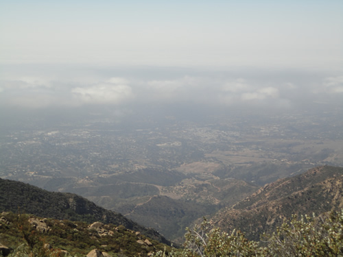
The ridge road was pretty cool, but by this point it was getting hot and we were running dry on liquids so it felt good when we finally found some down hill. Here is a shot of the city below and if you notice, it is a long way down!
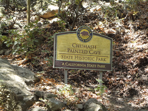
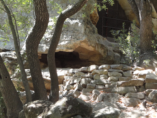
We descended via Painted Cave Road which is named for a Historic park where the Chumash Indians lived and made cave paintings. The park is aptly names Chumash Painted Cave and hence Painted Cave Road.
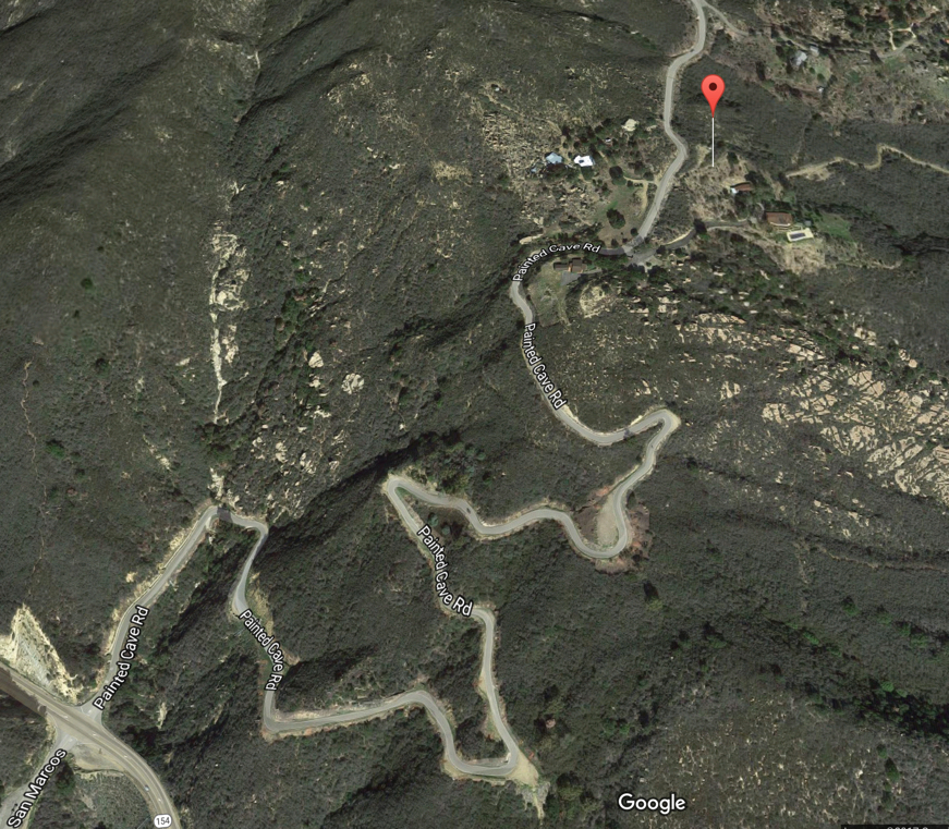
The road was insanely steep and narrow and at one point we stopped to let a car pass wich wasn't easy. Once past the cave, the road started into a series of switchbacks that were increadible. Probably the most switchbacked road I've ever ridden whcih explains how we were descneding so fast to the valley. Here is a Google Maps snapshot of teh road. Not sure it represents how bad it really is, but trust me, I love descending and switchbacks and it was hairy!
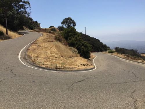
Here's a snapshot of one of teh real switchbacks for perspective.
Soon enough the ride was over and we headed back to the house in Solvang and got cleaned up for lunch.
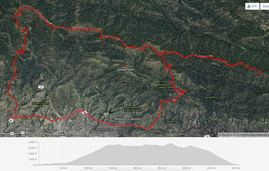
Here is the ride graphic and video
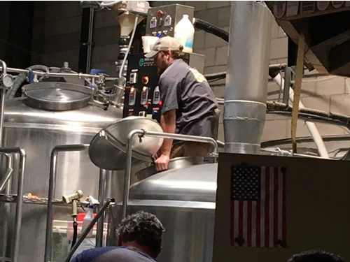
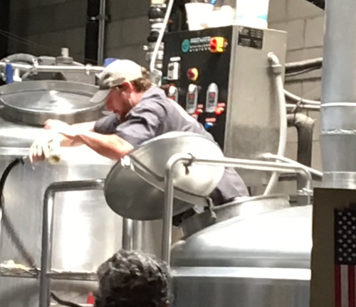
Lunch was at the main Figueroa Mountain Brewery in Buelton CA. We grew quite familiar with thier IPAs and frankly, it was good beer. The food was excellent also. Here's a picture of Tiffany in front of the brewing area.
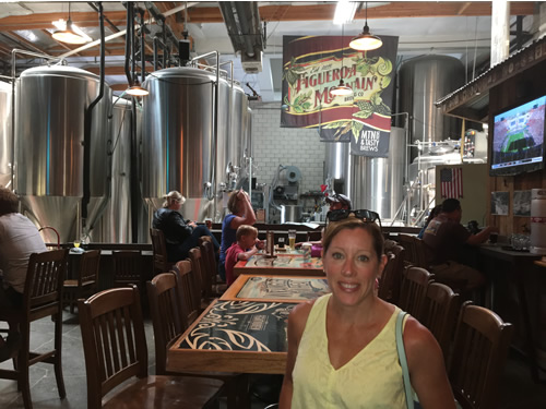
We were able to watch them clean one of the fermentation pots while we were there and the smell of wort and yeast was incredible.