Well, we have come down to our last day of riding and it's down to just Tom and I again. The weather was not that great today, overcast and drizzling on the lower portions of the climb. The bottom line is that the overcast didn't clear today while we were on our ride, but there was sun towards the top and of course back over the ridge in Solvang, it was gorgeous.
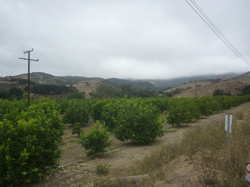
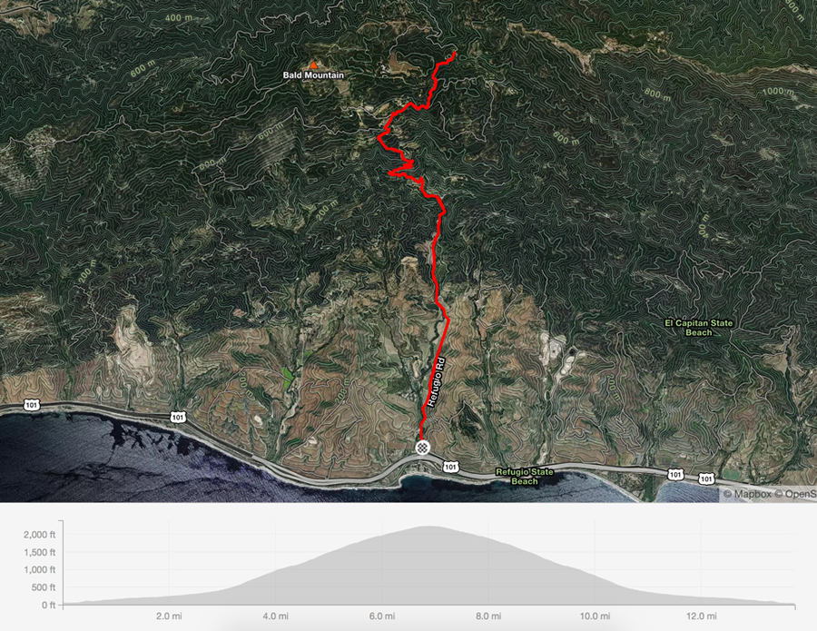
The ride today started out at Refugeo Beach where we just parked the car on the side of the road just off the highway off ramp. Here in the States, we usually can find a parking lot to start from but today we are going old school Europe and parking in a dirt stretch on the side of the road. The ride started climbing slowly from the car and within 1/2 mile we were in the middle of incredible fruit orchards. More on that later. As with a lot of the California climbs, the road quickly turned steep and crappy. Just as the road turned up, we passed a ranch in the trees with a couple dozen horses all lined up and fully saddled waiting for a group ride. At the same time Tom had a duel with a charging dog who was luckily wagging his tail when I passed. The traffic has been pretty respectful all week and today really wasn't any different.
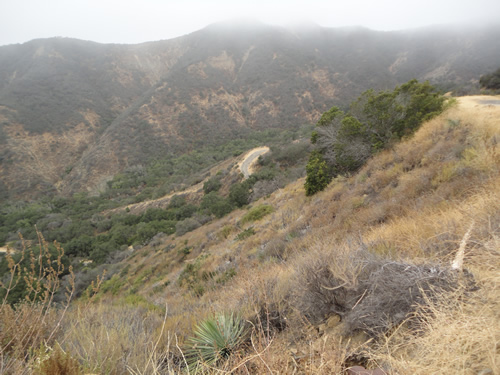
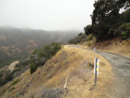
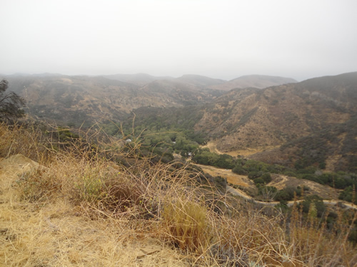
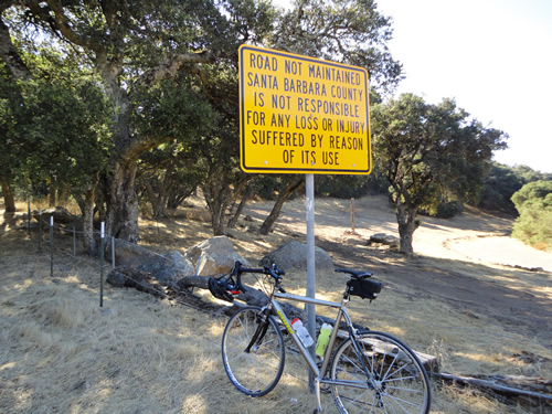
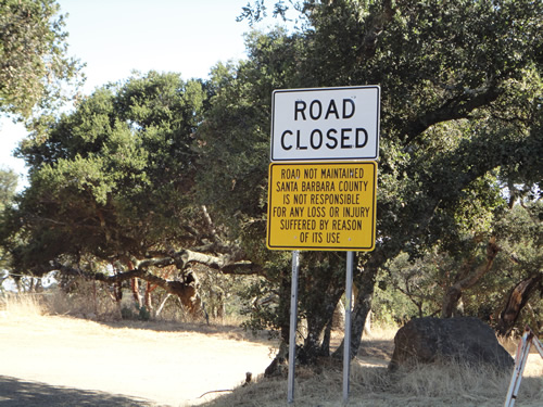
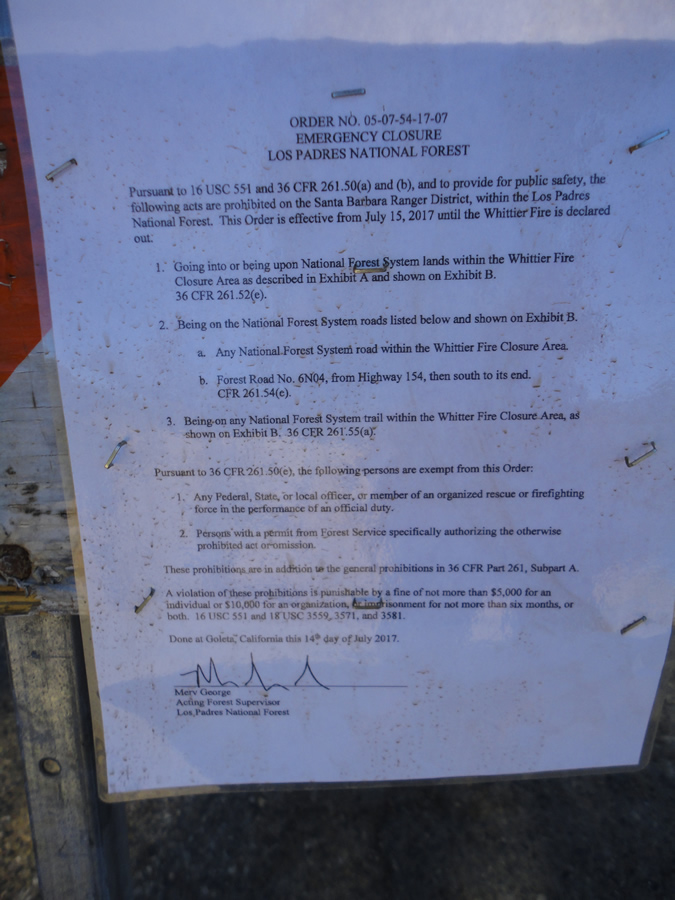
Unfortunately when we reached the first turn onto West Camino Cielo where we would have continued climbing, we found the road was closed due to the recent Whittier Fire. Too bad as we would have ridden on the ridge again almost back to the gun club we visited from a couple days ago when we climbed Old Stagecoach Road. We saw these warning signs about road not being maintained a couple times, including the road being closed but this time they meant it as you'll see below.
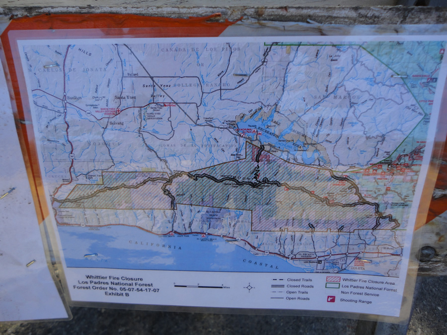
Up here were some interested things posted. First was a map of the fire area. The road we were climbing started right above the word California on this map and we made it to the T in the road before we found the closed road signs. Up to this point we saw no fire damage, but clearly we were in amongst the fire containment area. All the way to the right of the containment area is Highway 154, San Marcos Pass which formed the eastern boundary area and that is were we rode West Camino Cielo from Old Stagecoach Road. If you continued across San Marco Pass you would be at East Camino Cielo ROad which is were we turned down Painted Cave Road on yesterdays ride. Just to complete the orientation, Solvang was just over the ridge, northeast from where we reached the T in the road.
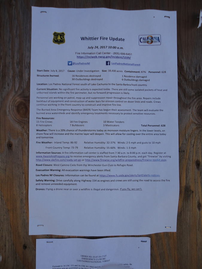
Also posted was this overview of the fire as of July 24, 2017 or about 2 weeks before we were riding. On this sign you can find all the information on damage, number of fire crews and equipment as well as weather and road closures.
And lastly the information telling you about the number of crimes you would be committing if you chose to enter this area. Wisely, as much as we wanted to ride the ridge again,we chose not to risk the $5,000 fine and potential 6 months in jail. Funny because while he was waiting for me, Tom saw a guy on a enduro motorcycle come out of the road and head down the hill.
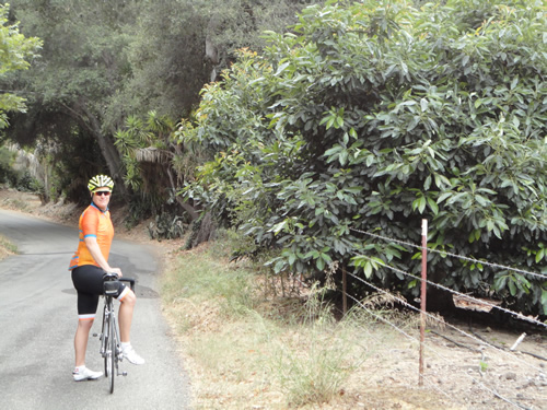
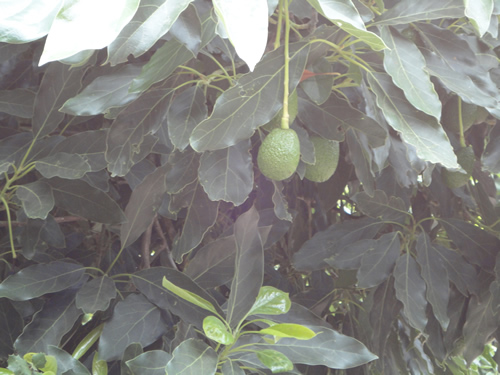
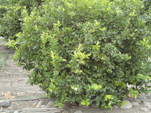
So at this point we headed down the hill, at a very slow pace due to how steep it was and also how badly broken up the road was. Frankly riding up hill the crappy road is a minor annoyance, but descending it can be plain miserable. Soon enough we were back on the pseudo valley floor and back into the orchards. Here is a nice shot of me next to some Avocado trees and also a picture of an actual Avocado growing on the tree.
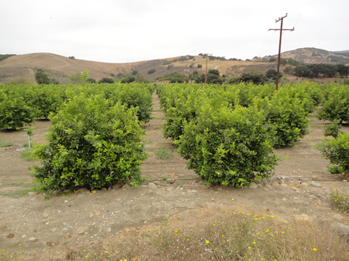
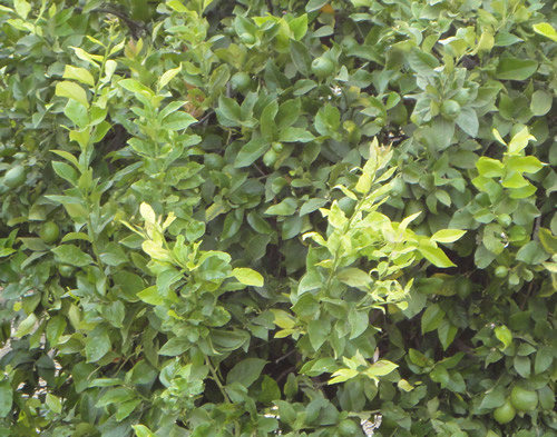
A little further down the road, we found a grove of Lime trees and got to listen to some wonderful Rap music while the Mexican laborers were tending the trees. In all seriousness, it was shocking how few workers actually were tending to some rather large areas.
And here is a close up of a Lime Tree and some Limes growing, although they can be difficult to see unless you look closely.
Soon enough we were back at the car and so ended our riding portion of the 2017 Trip to Solvang and Santa Barbara. Of note, other than the last section of road closed by the fire, this was the first trip where we rode every ride and every mile that I planned out. We altered the days in order slightly, but the fact is we covered the whole trip! I can't believe we executed one of these psycho riding trips completely ... approximately 225 miles and over 25,000 feet of climbing.
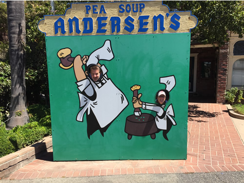
The day wasn't over though as when we got back to the house we decided to check out Pea Soup Andersen's which claimed to have spectacular Pea Soup. It was pretty good and the Ruben I got to with it was dam good also. It didn't sit so well that night, but hey, it's all about the moment. The restaurant itself looked to be more Appalachia than California. Tom and Tiffany couldn't resist a bit of hamming around after lunch!