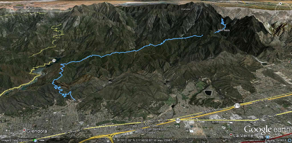
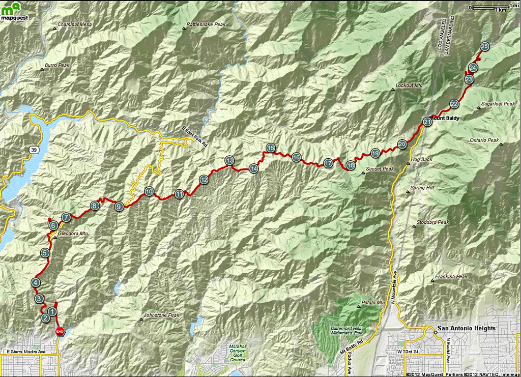
Mt Baldy is a popular climb right outside Los Angeles California. It featured in the Tour of California in 2011 and is planned to repeat in 2012. The finish to the Tour of California finished in this parking lot to the ski area. There are several approach routes that can be used to get to the final climb, but all overlap somewhat and all converge in the town of Mt Baldy which is a small ski town. The shortest route starts in San Antonio Heights and directly climbs Mt Baldy Road from the valley through the town and to the summit. The Tour of California has traditionally started their stage by climbing this route and deviating away from Mt Baldy once outside the town by crossing Glendora Mountain Ridge until they descend Glendora Mountain Road, passing the San Gabriel and Morris Reservoirs entering the valley via the San Gabriel Mountain Road. This descent by the reservoirs would be a second path to begin ascending to Mt Baldy. After entering the valley, the Tour of California stage crosses to Glendora where the peloton climbs Glendora Mountain Road from the south, crossing Glendora Ridge Road to Mt Baldy before finishing at the summit. This path from Glendora to Mt Baldy is the one described in this ride page.
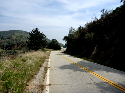
The best place to start the ride is from a dirt parking lot just past the fire station and equestrian center. This lot seems to be popular with cyclists. From this spot, Mt Baldy is about 25 miles away, and you'll have over 7,000 feet of climbing to get there and return via the same path over the ridge. Glendora Mountain Road is a reasonable climb, about 7-8 miles averaging 5 or 6%. The ride over Gendora Ridge Road is and narrow land and a half road with little traffic that has rolling ups and downs in the same 5-6% range, but much of this part of the ride is much less severe. The final section into Mt Baldy is a steep 1-2 mile downhill which is your last relief prior to what is a major sufferfest to the summit. The final climb to the ski area starts about 8% climbing out of town and slowly increases in gradient to a mind numbing 15+ percent over the final mile.
Was able to ride this route on my way to Los Angeles to catch a flight home after attending a conference in San Diego. We parked in the dirt lot on the start of the route and there were several cyclists coming and going which was encouraging considering the weather was foggy and overcast earlier in the AM. Tom made one of his signature videos as we started the ride.
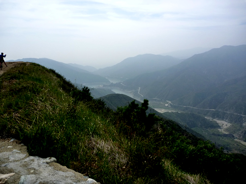
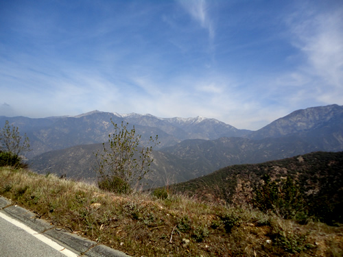
The ride up Glendora Mountain Road was not too steep averaging between 4-6% and was loaded with switchbacks. I love riding on small tight switchbacks so this ride was feeling like heaven to me. We seemed to be able to make good time also as the temperatures were perfect for climbing. The lower secitons of the climb had lots of climbing with forrest on one side and steep drop offs on the other. The road surface was perfect and all the switchbacks were banked whcih made the descent a blast. Near the top of the climb, we got great views of the San Gabriel and Morris reservoirs.
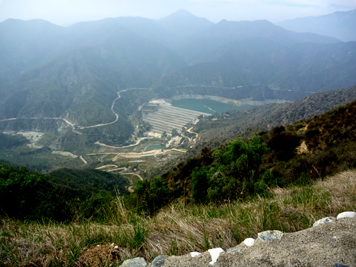
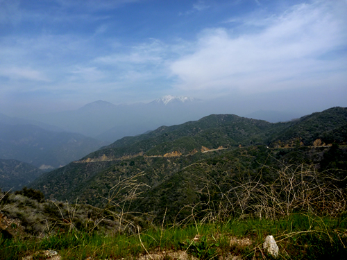
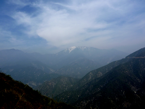
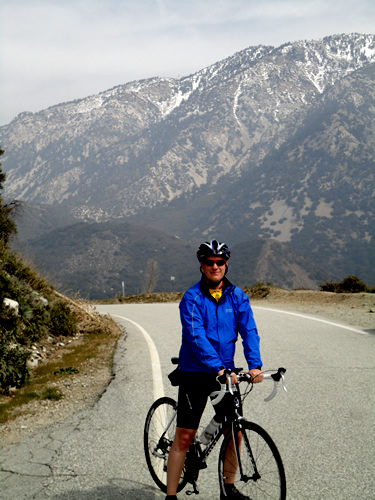
Glendora Ridge Road was simply spectacular to ride on. It was about a lane and a half ride and there was zero traffic on it. I think that this ride id the most European of any rides I've done here in the US. The road undulated with no really hard climbing or descending for over 10 miles. That isn't to say it was flat, because in mo way was this road flat, the climbs were just gradual and not very long. In several places we were riding across open ridges with very steep and deep drop offs on both sides of the road. Below are a couple pictures showing some of the scenery on this road including showing Mt Baldy in the background!
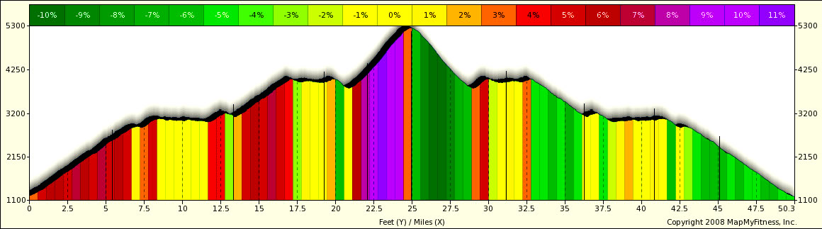
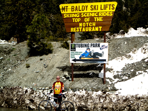
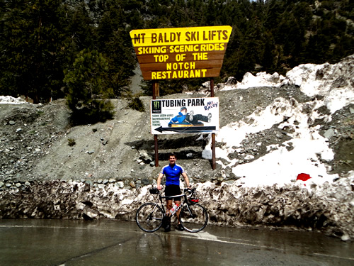
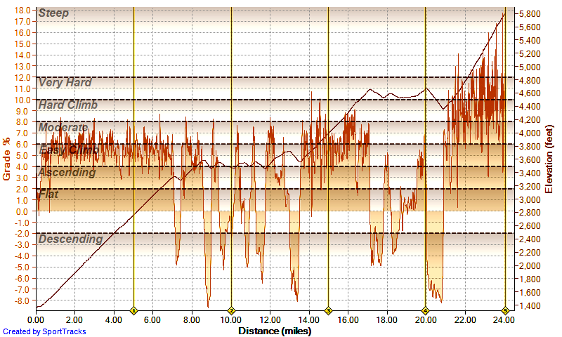
The town of Mt Baldy was small and about what you'd expect from a ski town. Unfortunately I didn't get any pictures of the town before we started the final climb. Through town, the climb didn't seem too bad, although it was clear to me that the gradient was steeper than we;d faced all day. I also started to feel the effects of 20+ miles of climbing almost immediately. I remember hearing that this climb got harder as you rode, but man they were not kidding. The initial gradients were 7/8 % in town. As we rode out of town, Tom accelerated away as usual and I tried to maintain a consistent pace as the average gradients increased to between 8-10% where they stayed for the rest of the climb. About 1.5 miles into the climb, the gradient started to kick between 10-12% periodically, while after 2 miles, the 12%+ gradients kicked in. A little while after 3 miles into the climb, my GPS batteries started to die and as a result, I lost all data after this part of the climb. You can see the altitude plot and gradients in the chart below. That is a shame because the last 1-1.5 miles of this climb were the hardest climbing I have done since I rode the Zoncolon. Now, before you compare this to the Zoncolon, it wasn't that hard, but it was very steep and with 23-24 climbing miles in my legs and being early spring, I was suffering like a dog to just move forward. Right about 1.5 miles from the finish is a slight downhill which is good, because things get particularly sadistic after that. The last mile had to be in excess of 15-18% and it was the first time on many years I seriously considered quitting and turning around. Thankfully, I found the strength to finish and made it to the sign marking the bottom of the ski area. I have no idea how Levi and Chris Horner raced as hard as they did on this crazy finish! Below you can find pictures of Tom and I at the top of the climb.
The descent down Baldy was no piece of cake either, very steep and a bit chilly. We stopped in town at a bar and got some well needed Coke and refills of water for our bottles. The woman working at the bar was really cool, said she saw us coming and set out pitcher of ice water for us to use free of charge. There were a couple other cyclists there, including a guy who had climbed from San Antonio heights. He was having a bowl of chili before finishing the climb. After the refreshing drinks we started back up the little climb on Glendora Ridge Road, it turned out to not be as bad as we had envisioned. Tom made another video clip documenting how we were feeling.
We pretty much rode pretty well from here back to the rental van as all the bonus miles on the way up were really not bad to climb on the way down. As I mentioned before, the downhills were all well graded and it was like racing at Daytona in the corners. Very nice, very fast. Unfortunately my GPS problem amplified about 40 miles into the ride when the batteries completely died. I was able to repair the Garmin file to retrieve 24 miles of data but I lost the rest. When i had last looked we had just passed 7,000 total feet of climbing and since we were about to start serious downhills, I think we were not going to see appreciable extra feet upwards. We did see a fox sitting on the side of the road watching us as we flew by. We tried to stop to get a picture, but he wasn't interested in waiting around an there was no sense provoking him into an attack by chasing.
This was a great ride and I would love to do it again. Below is what data I was able to retain. I lost about 1 mile of the final climb to Baldy and the entire return trip. It took me about exactly 3 hours to reach Mt Baldy from the start in Glendora.
|
|