Natural Bridges National Monument Ride
This challenging ride can be shortened by parking at the Mule Canyon Ruins (20 mi. from Hwy 191). User fee or a Park Pass is required in the National Monument.
The Trail of the Ancients travels across the Cedar Mesa, an area extremely rich in archeology. Mule Canyon Ruins, an easily accessible site, comes shortly after crossing Comb Ridge. Our ride starts after the descent into Mule Canyon.
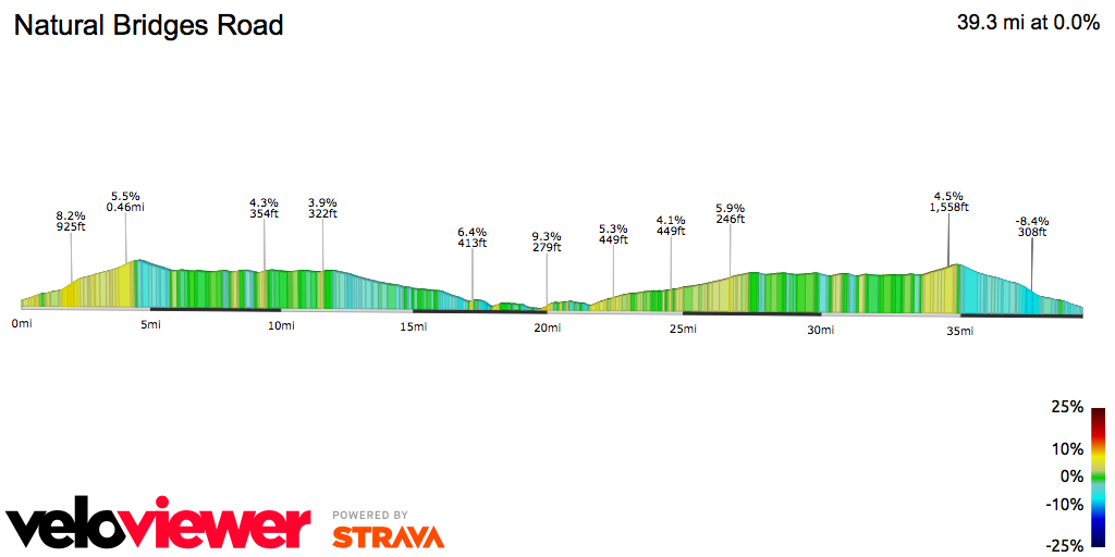
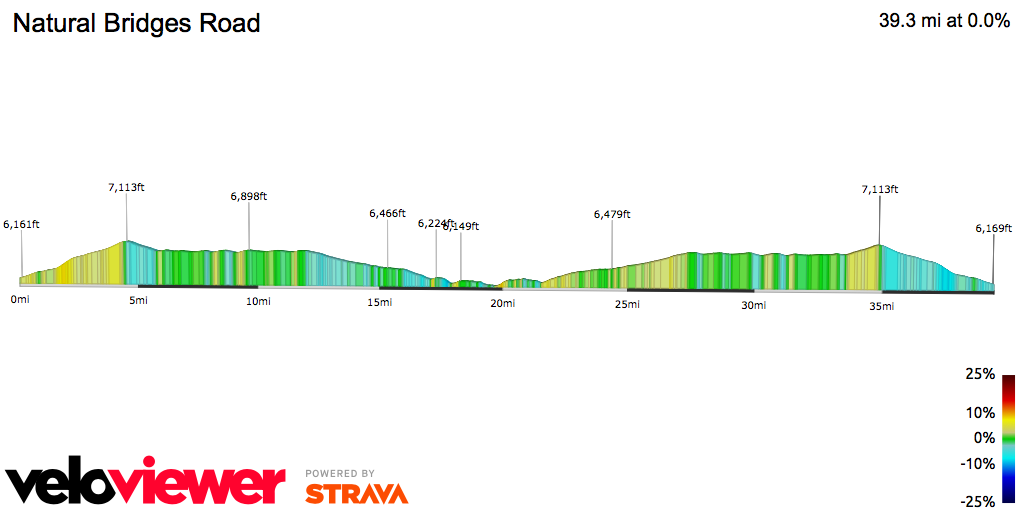
From here, SR 95 climbs to the highest point of the ride (7,140 feet, although a sign along the road at the Salvation Knoll viewpoint states 7,110 feet). Here, as above, the highway’s narrow shoulders is compensated with a climbing lane that allows room for passing motor vehicles. You are now at the 29.6 mile mark; during the climb, looking upward and to the right, you will have noted the Bears Ears (mountains) – perhaps so-named because the highest peaks appear to be shrouded in dark green blankets. The adjacent landscape is otherwise somewhat barren. From here, the highway descends to cross a couple of gorges (South Fork Fish Creek and Lyman Canyon). At the junction with SR 261 (mile 33.8), keep straight, remaining on SR 95. The highway continues to climb and descend through here. At mile 35.6, turn right onto SR 275, toward Natural Bridges National Monument. The shoulder is narrow, and weeds tend to encroach upon what little shoulder there is, but traffic volumes out here are very light. Enter Natural Bridges at mile 39.5. A visitor center is just up the road. A stop here to freshen up may be worthwhile.
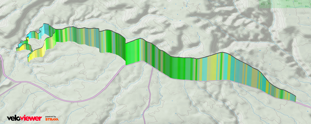
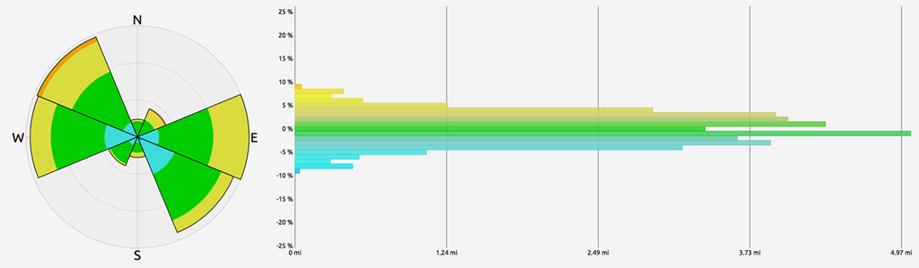
Once beyond the visitor center parking lot, bear right at the “Y” – you are now on a 9.4-mile, one-way loop road through Natural Bridges. This hidden gem was not “discovered” (that is, by non-native settlers) until 1883. The Monument features three of the largest-known natural bridges in the world: Kachina, Owochomo, and Sipachu. Each of the bridges can be seen from overlooks that require short walks from the loop road. You may be able to catch glimpses of the bridges from the road, but each one is worth the walk. The Monument otherwise features some sheer cliffs, spectacular sinks, sandstone formations, and expansive vistas, all of which can be viewed from the road. Of particular note are the Tables of the Sun, flat-topped mesa-mountains that can be seen off in the distance along portions of the loop. As for the road, it rolls through the Monument, constantly climbing or descending. There is a narrow shoulder on the left; none on the right. There is a short, two-way segment near the end of the loop, as you near the visitor center.