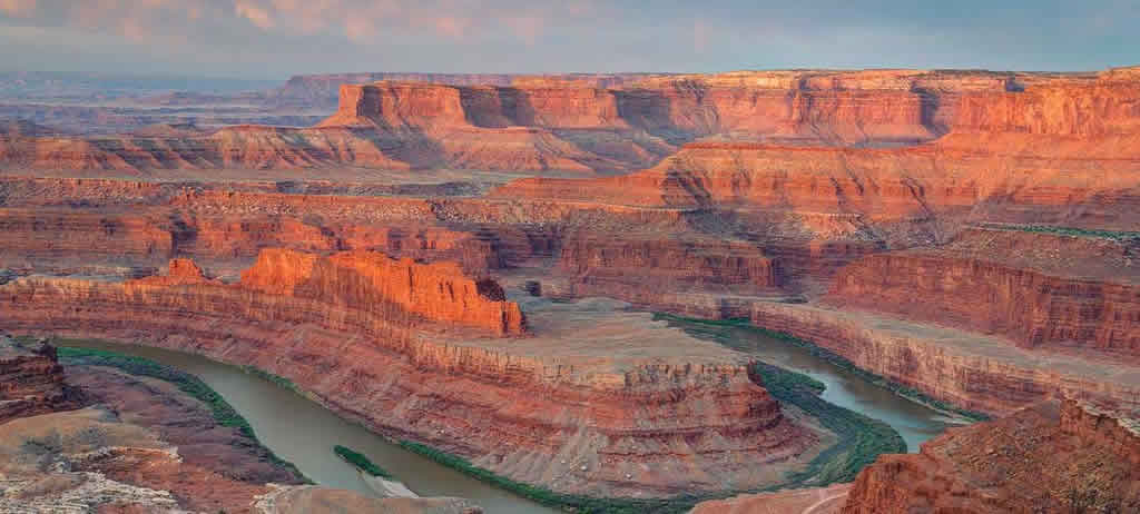
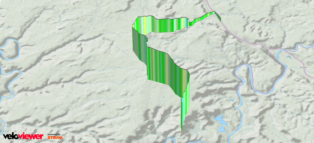
Deadhorse State Park
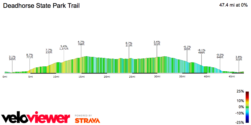
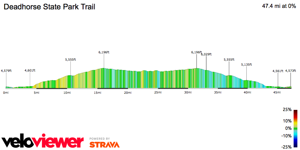
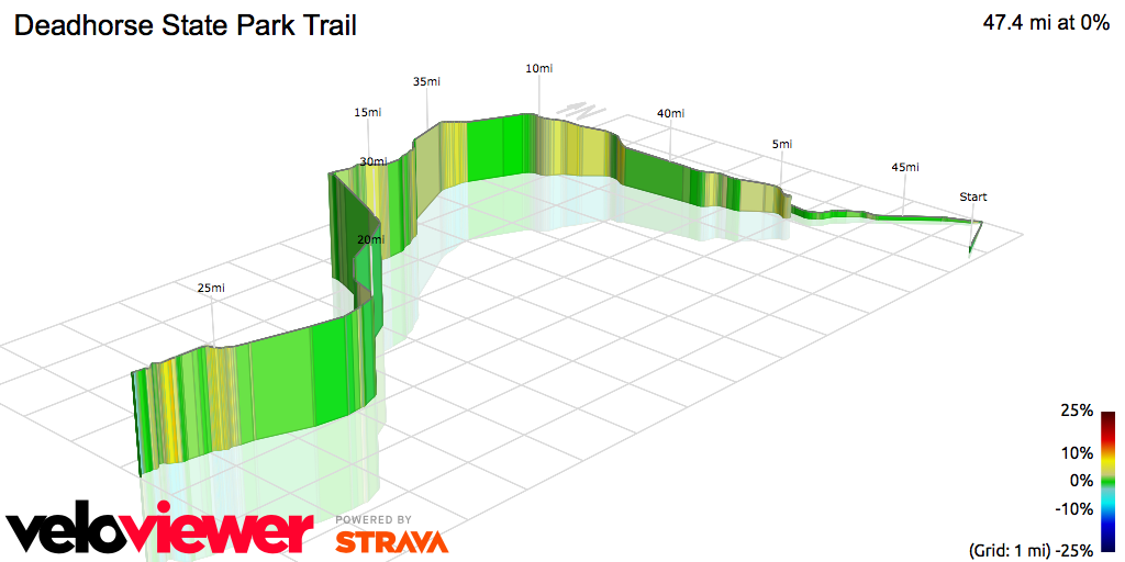
Another mashup description from a couple different rides:
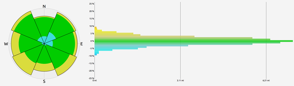
At this point, the substantial climbing begins, and so do the views. Off the right are Monitor and Merrimack buttresses. The view of Henry Mountains, the Abajos and the La Sal Mountain ranges improves as you ascend the climb. From there, it’s high desert riding until you reach Dead Horse Point State Park. The Point is a few miles from the prize, a sweeping view of the Colorado River below and geology that will make you gasp.
Starting at the Dead Horse Point State Park visitor center. Turn left upon exiting the parking lot, and head toward the Dead Horse Point overlook. The road undulates and winds for 1.3 miles before entering the overlook parking area. Notice the cliffs and deep canyons on either side of you. You will not be able to see the overlook unless you dismount and walk to the end of the short path, adjacent the parking area. It is worth a peek — the Colorado River winds its way through the canyon-scape some 2,000 feet below. Legend has it that cowboys used the mesa as a natural “corral” for wild mustangs. The series of flat stones along the road as you near the overlook were one of the techniques for confining the horses to a certain space. The neck here is only 90 feet wide, leaving little opportunity for any horse to escape. The good horses were chosen from the bunch, while the others were left corralled. Horses that went unselected eventually died on the point from thirst (a sad ending; no horses were known to leap into the canyon).
There is a $2.00 fee per cyclist to enter Deadhorse State Park.