We'll park for this ride at the Leavitt Meadow Campground (Parking map on campground page). Follow Hwy 108 west for 6 miles. Leavitt Meadows is left side of the highway. It is visible from the road and is marked with a sign with day parking for trail use. Thsi shortens the planned ride by 6 miles on start and finish so the overall ride will now be about 45 miles depending on turnaround.
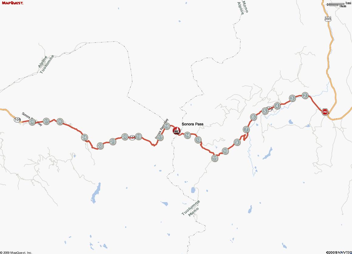
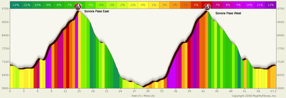
An eighty-mile-long paved highway between Sonora and U.S. 395 that climbs the gradual western slope of the Sierra Nevada to the summit of 9,624-foot Sonora Pass. The Sonora Pass scenic drive twists up forested ridges on the gentle western slope of California’s mountain backbone, the Sierra Nevada, to the airy summit of 9,624-foot Sonora Pass, one of the highest automobile roads in the state. The drive follows paved California Highway 108 and offers a wealth of scenic vistas and recreational opportunities. The road’s upper reaches from Kennedy Meadows on the west to Leavitt Meadow on the east is unsuitable for large RVs and trailers. The highway over the pass is extremely steep (up to 26% in some locations), narrow and winding between Kennedy Meadows on the west side and Leavitt Meadows on the east. The route is not recommended for vehicles or vehicle combinations that are unusually wide, heavy or long
SR-108, from its the junction with US Hwy. 395 to the Sonora Pass toward the west is a 2-lane route with minimal shoulders and very steep grades. Traffic is light. Exceptionally scenic, this route traverses the High Sierra and peaks at Sonora Pass. During the winter months route 108 is closed.
Sonora Pass Ride Trips: Chain Reaction, Adventures on a Bike,